Business Data
Highway Transportation
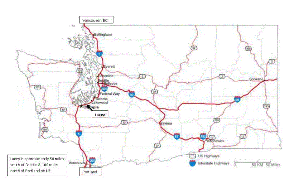
HIGHWAYS–Lacey is located on the Interstate-5 corridor between mile marker 108 to just past mile marker 111. The mile markers reflect the distance from the southern border of Washington (Portland, Oregon city limits.) The Washington Department of Transportation map, below, identifies the routes of major highways (in gold) and freeways (in blue.) Interstate-5 runs from the Mexico border, just south of San Diego, California, north through Oregon, through Washington, and ends at the border crossing just south of Vancouver British Columbia, Canada. Interstate 90 (the blue line running all the way to the eastern border of Washington) originates at Interstate-5 in Seattle, crosses Washington just east of Spokane, and crosses the entire country ending in Boston, Massachusetts.
TRAFFIC COUNTS
The City of Lacey performs new traffic counts on arterial streets every three years. Each year traffic counts on about 1/3 of arterial streets are updated. Here are the most recent data.
WANT TO KNOW MORE
If you don’t see what you’re looking for here, please contact us. We will be very happy to locate the data—the information—that you’re seeking!